
Walk a Madison County Street
A Madison County street directory search starts with one complete address and grows outward. The tax roll gives ownership evidence, while the map shows the parcel in context. A deed then links that owner to the seller, legal description, and filing date. Voter material and old directories are separate evidence. They can support a residence link, but no single record should be treated as a full household list.
- Enter the street address in AssuranceWeb Property. Save the current owner, situs address, PIN, parcel description, and owner mailing address.
- Open Huntsville Find a Property when the address lies in its coverage. Draw around the street, submit the shape, identify a lot, and choose View Property Info.
- Use the owner and legal description in the Probate recorded-document portal. Follow the purchase deed and search the grantor as an earlier grantee.
- For civic research, use Alabama's official voter-list request route. The public individual voter tool is not a street browser, and a voter list still omits nonvoters and protected data.
- Test an older address in directory and map collections. A criss-cross source begins with a street or address, while a name directory begins with the resident.
The reliable flow is address to parcel, parcel to owner, owner to deed, and deed to the earlier owner. Only then should other sources be compared. This keeps ownership, occupancy, and address history from being blended into one unsupported claim.
Madison County Street Search Fields
The Tax Assessor's current portal offers more than a simple owner-name box. Address mode is the direct start for a street directory task, while PIN, parcel, account, subdivision, and owner modes help when spelling or postal changes block a match. The current URL is set to the 2026 tax year, and the earlier online range is not stated in the official material.
| Portal control | Input | How it helps by address |
|---|---|---|
| Tax Year | Selector | Identifies the roll being searched |
| Search By | Name, PIN, Company, Parcel, Account, Subdivision, Address | Switches from a street address to another property key |
| Last Name Match | Starts With or Contains | Helps after an address yields an owner name |
| Search | Text field | Accepts the main value for the chosen mode |
| Optional Search | First name in Name mode | Narrows common surnames |
A parcel is a mapped unit of land. The situs address is the physical location, while the owner mailing address is where tax mail goes. Those fields may differ. That difference is evidence that title and day-to-day residence are not the same fact.
The Madison County CityView property locator shows how an address or PPIN can open permit and inspection information.
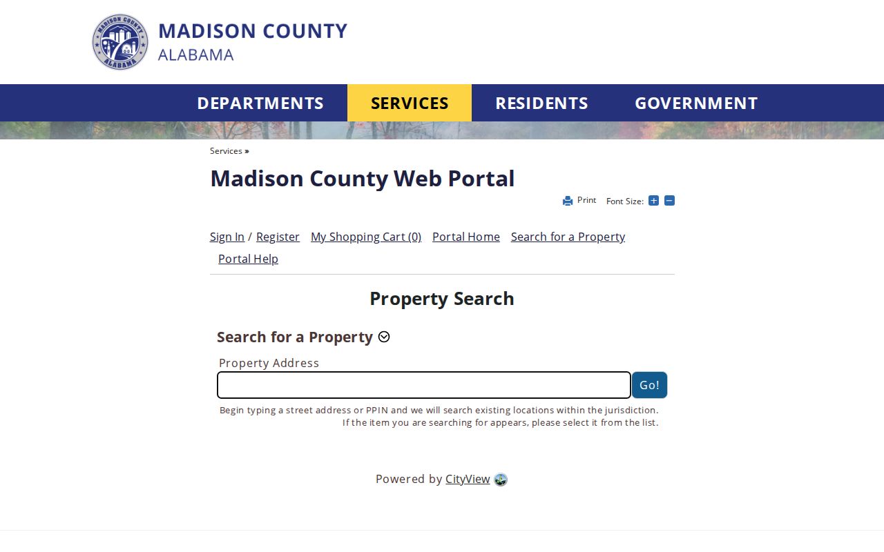
The locator supplies an address-based fallback for unincorporated-county permit evidence, though an applicant or contractor name does not prove who occupied the site.
Browse Madison County Street Parcels
Huntsville's map can inspect a whole block when an exact address search is too narrow. Draw a polygon at the lower left, select Submit, use Identify, then open View Property Info for each selected lot. There is no documented public buffer button. The service caps a selection at 2,000 records, so a tight shape works better than tracing a long road.
The map filters by acreage, value, county, empty-lot status, historic building, wetland, zoning, flood area, school district, historic district, industrial park, road frontage, traffic counts, and several other planning layers. Its parcel schema includes tax year, property address, PID, acres, value, zoning, and district or environmental fields. Owner and mailing fields are absent from the city layer. Return to the Assessor for them.
The official parcel and block viewer shows the controls used for that Madison County street directory step.
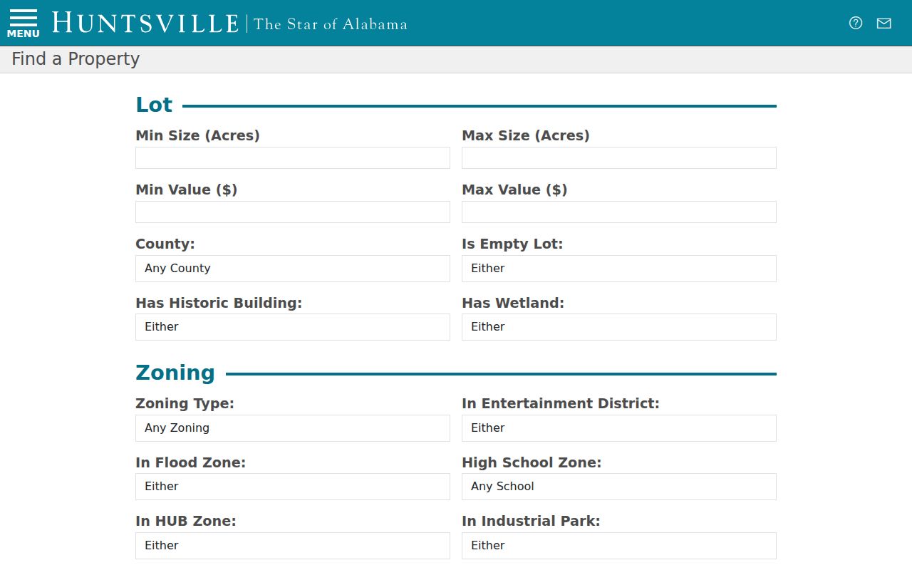
The image anchors the map workflow: geometry and district context come first, while ownership comes from the county roll linked after parcel selection.
Note: The City warns that it does not maintain parcel data and cannot guarantee the map's spatial or time accuracy.
Madison County Records by Street
No Madison County street directory source answers every address question. These records overlap, but each proves a different point. The PIN and legal description are the best links between them because those keys often survive a changed street label.
| Address record | Local keeper | Street evidence | Access route |
|---|---|---|---|
| Tax roll | Madison County Tax Assessor | Situs, titled owner, mailing address, PIN, value | Free AssuranceWeb search |
| Parcel map | Huntsville or County GIS | Lot shape, nearby parcels, zoning and district layers | Free map, then Assessor |
| Deeds and plats | Madison County Probate Judge | Grantor, grantee, legal description and subdivision | Free account, counter, email, mail, or archive |
| Permits | City or County inspection staff | Work type, status and address-linked filing | County CityView or City records request |
| Voter records | Alabama SOS and Probate Elections | Individual status or a quoted geographic voter extract | Official lookup or request form |
| Historic directories | HMCPL, HHC and ADAH | Named resident, work, home or business address | Digital collection or in-person shelf |
| Sanborn maps and aerials | Library of Congress and City GIS | Building footprint, use and physical change | Free online images |
A plat is a recorded map of lots and streets. A legal description identifies land by lot, block, subdivision, or metes and bounds. Neither is a resident list, but both can keep a street search tied to the same land when names and numbers shift.
Madison County Deeds Along Streets
After the assessor identifies an owner, the Probate deed index supplies the transfer trail. Record the grantor, grantee, instrument type, filed date, document or book and page, and the legal description. Search the seller next as an earlier grantee. Probate indexing treats aliases, former names, trusts, trustees, estates, personal representatives, MERS, and business roles as separate indexed names. Testing those roles can rescue a deed chain that seems to stop.
- Grantor
- The party transferring an interest in a recorded instrument.
- Grantee
- The party receiving that interest.
- Criss-cross directory
- A directory arranged by street or address, useful when the name is unknown.
- PIN
- The parcel identification number used to connect tax and land records.
Online recorded documents require a free account, and the official online cutoff is not stated. Requested copies cost $1 per page plus $2 for certification. When the online trail ends, contact Probate instead of guessing. Active recording is at Memorial Parkway. Historic files are kept at the Owens Cross Roads archive, with appointment, email, and mail routes available.
Madison County Street Name Bridges
Huntsville's address history can break a literal street search. A 1958 ordinance changed Oak to Gallatin, Madison to Poincianna, and High School to Pansy. Comer disappeared, while Brandon was extended. Bob Wallace began with a 1909 subdivision and expanded east in 1928. An old directory may also locate a home as “Holmes between Washington and Green” rather than use a house number.
The fix is to carry the legal description, subdivision, and PIN across time. Sanborn sheets from 1884 and 1898 can show a structure's footprint and use, while city historic aerials begin in 1937. Those maps do not name an occupant. Pair them with deed parties and directory entries. For a fuller account of the old volumes themselves, use the Madison County city directory collections.
Huntsville addresses also use NW, NE, SE, and SW quadrants. An incomplete street name can point to the wrong place, especially when the mail city spans more than one government boundary.
Madison County Voters by Street
Alabama Votes' My Voting Information verifies a known individual. It is not an open by-street directory. A nonmatch does not prove that someone left Madison County, since formatting, a recent move, inactive status, or a protected record can affect the result. Alabama also does not register voters by political party.
A broader voter list is requested separately under Alabama Code sections 17-4-2, 17-4-33, and 17-4-38. The official form can ask for a county, city, or district and fields such as residence, mailing address if available, registration date, status, precinct, and voting history. It can be delivered by mail, email, or pickup in paper, Excel, or tab-delimited form. The Secretary of State quotes the charge before payment. Electronic lists cost $0.01 per voter, while printed lists cost $1 per page.
Voting history means participation, never a ballot choice. Social Security numbers are withheld, and a qualifying protected voter may appear by name only. A delivered file can be sorted by street for lawful civic research, but it covers registered voters rather than every adult or household member.
Madison County Address Assignment
County Public Works assigns addresses only in unincorporated Madison County. A new address requires recorded-deed ownership, at least 30 feet of access to a county road through ownership or a recorded easement, and a $25 cash or check fee. The request supplies the owner or business, PIN or marked aerial, subdivision and lot, road, nearby intersection, and structure type by email.
Huntsville follows a precise lookup form: house number, street name, street type, quadrant, and optional unit. A number cannot start with zero, and the street name begins with a letter. Only the house number and street name are required. Unit may also be written as Apartment, Apt, or Suite. These details matter when an address seems absent from a street directory even though the parcel exists.
Madison County Records Behind Permits
Permit evidence can date work at an address and show the filing status, applicant, or contractor. It cannot prove who lived there. For unincorporated Madison County, CityView offers an address or PPIN property locator and permit or inspection-status functions. That makes it a useful second check after the tax roll.
Huntsville ePlans is an application tool, not a verified anonymous history search. Historical city permits must be requested through the City Clerk's public-record procedure. The City requires its completed form, starts with a nonrefundable $25 minimum for one labor hour, charges more labor in full-hour increments, and may require advance payment. It acknowledges a request and supplies a tracking number, but it does not promise one fixed completion time.
Limits of Madison County Street Records
A titled owner is not automatically an occupant. The tax roll does not list every person at a home, and a deed records an interest in land rather than a complete household. Permits may name an applicant or contractor. Voter files omit people who are not registered and suppress protected information. Utility customer data, delivery files, and motor-vehicle addresses are not part of this public street-directory method.
Postal labels can also mislead. A Huntsville or Madison mailing city can cross into Limestone County, so the mail city alone does not choose the assessor, Probate office, court, municipality, or school system. Confirm the parcel and city limit in GIS before requesting a record from a custodian.
Lawful use. Use Madison County address records only for lawful personal, family-history, property, or civic research. Never use them to stalk, harass, intimidate, or harm anyone.
Note: A street directory result is a lead that should be checked against its date, keeper, and stated coverage.